


Locals have lamented the loss of livelihood and cultural traditions due to land reclamation projects off the coast in the Portuguese Settlement, of Malacca.
Portuguese Serani community activist Martin Theseira was one of the fisherfolk living in the settlement for 20 years when the land reclamations there first began.
In the time since he has witnessed the number of fisherfolk in the community decrease by more than half - despite the community's traditional reliance on income from fishing - due to land reclamation projects close by.
“Now there are more fisherfolk than fish,” he told Malaysiakini.
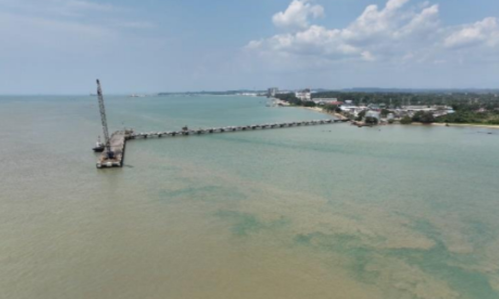
A newly released environmental impact assessment (EIA) report showed that Leaptec Engineering Sdn Bhd entered into an agreement with the Malacca state government for the reclamation of two islands at Tanjung Kling, along the coast of Pantai Puteri to Sungai Lereh.
The project is part of the state’s overall strategic development plans for the Melaka Waterfront Economic Zone (M-WEZ), the report said.
The project has a total area of 274.859 ha and is expected to include a port, industrial areas and offices.
The EIA noted that the udang geragau population in the area may be affected, along with other marine animals.
Income affected
The udang geragau, or acetus in English, is a small shrimp native to the area that is usually processed to create cencaluk or belacan (shrimp paste).
Traditionally, the Portuguese Settlement - a sleepy coastal village which comes alive a few times a year for cultural activities - was where locals went to buy large balls of fermented shrimp.
But Theseira has not bought geragau in the settlement for 15 years now.
“I bought 50kg 15 years ago from a friend.
“What we use now to make cencaluk, we buy from Pantai Puteri,” he said.
The catching of geragau used to be an annual arrival, part of a six-month season from April up until almost late November or December.
The Portuguese Serani in the settlement regarded it as the best source of income during the days before the M-WEZ land reclamation project, which sits 100m away from the shoreline.
“Those days you could earn a living as fisherfolk by using a butterfly net at the coastal waters and standing in the water waist deep.
“You could survive on the income then and if you're hardworking enough, you could harvest as much as you want,” Martin explained.
“It's not the geragau that gives up but the fisherfolk,” he added.
According to him, those days are long gone and now the butterfly net is just a relic for museums.
Because of the sedimentation and pollution, fisherfolk now require more capital to buy bigger boats with larger engines to go out further to sea for a catch.
Even then catches are unpredictable and require more luck than skill, he added.
Traditions lost
According to environmentalist Dionysius Sharma, the geragau relies on several environmental characteristics to spawn: the sea is shallow for a great distance from the shore; the area is separated from the open ocean by a peninsula, submarine sills or numerous islands; the tidal range is considerable; and the bottom is covered with mud or sandy-mud.
"I used to live at Praya Lane, Bandar Hilir and used to see Malaccan Portuguese fisherfolk using the push-net (langgiang) to catch the geragau at the sea behind the Assumption Church.
"All that is gone as a result of the land reclamation for the new township of Melaka Raya.
"So, a traditional way of life of catching this seasonally abundant resource and making the much loved fermented cencaluk and belacan is now lost and gone forever,” he told Malaysiakini.
Dionysius added that now it is inevitable that the geragau population continue to deplete amid increasing coastal reclamation projects.
Meanwhile, nature lover and retired technologist Frits van Walsem has spent recent years flying a drone and documenting land use changes along Malacca's coast.
He noted that a narrow drainage channel of only 50m has been planned for one of the two new islands.
"The channel is supposed to prevent the disruption of the drainage of the area north of Spring Garden.
"However, this channel will be connected to the Sungai Lereh Estuary, which carries muddy fresh water from other rivers in the hinterland," van Walsem noted.
"During high tide (twice a day), the muddy river water will be forced into this channel and deposit its sediment.
"Within two to three years, this channel will be filled with mud, blocking the drainage water from the local area and potentially causing flash floods in the Spring Garden and Tanjung Kling area,” he said.
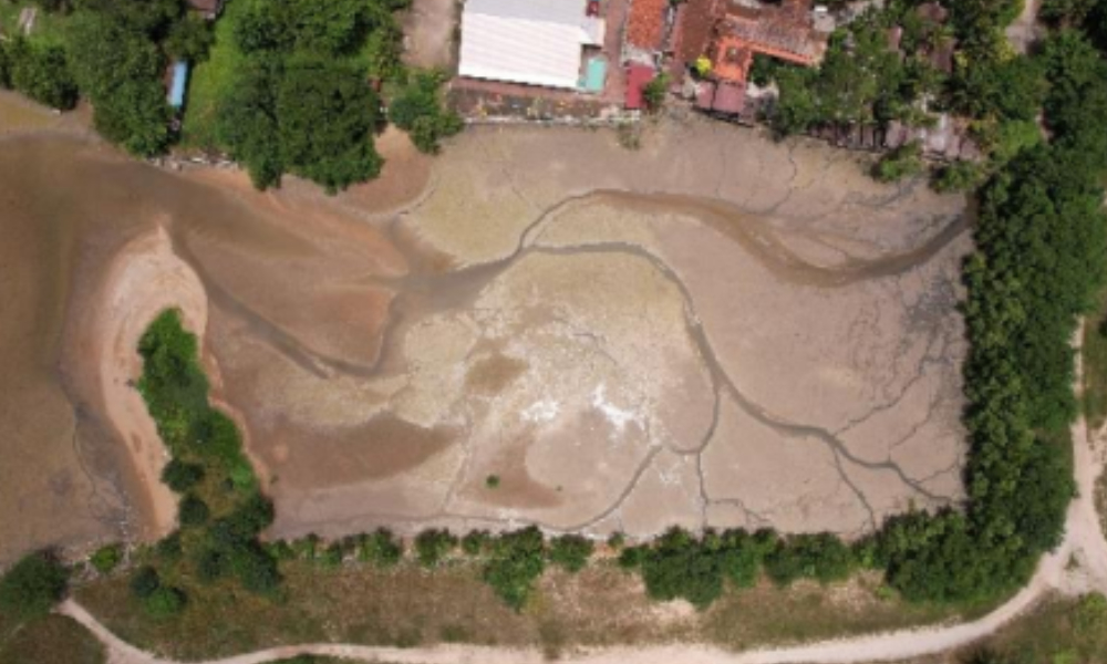
Besides that, the new land has created many coves, which will quickly become muddy and full of silt, he said, citing past examples.
Further, the health of residents of condominiums nearby is a concern as one of the two islands has been designated as an industrial zone - although the EIA does not specify which industry.
"This raises concerns for the health of the residents living in the high-density condominiums surrounding island one on the north side, especially if the island hosts polluting or hazardous industries,” Frits pointed out.
Malaysiakini has reached out to the developer for comment. - Mkini
No comments:
Post a Comment
Note: Only a member of this blog may post a comment.