


Fire prevention is key to protecting peatland swamps and surrounding communities should be at the frontline in such efforts.
They may look like unloved bogs nobody would take much notice of but peatlands play a crucial role in soaking up carbon dioxide (CO₂) emissions.
While peatlands cover only three percent of the global land area, they store nearly 30 percent of the world’s soil organic carbon and contain twice as much carbon as the world’s forests and play a key role in nature-based climate change mitigation.
Keeping peat carbon in the ground, therefore, is crucial if the world is to meet the 2°C threshold set by the Paris Climate Change Agreement.
Important as they are, the depletion of peatlands continues worldwide at an alarming rate. Massive peatland fires and human activities are mainly responsible.
Extremely flammable
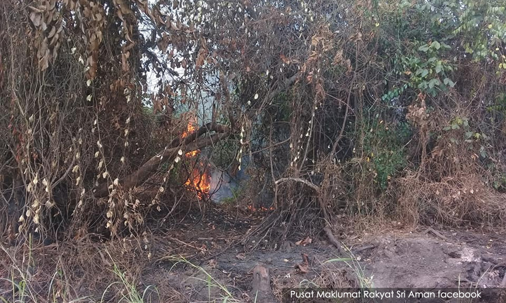
Peatlands are more vulnerable to destruction by fire compared to other forest types due to high organic matter in the peat soil.
These are extremely flammable when dry. Peat fires emit large amounts of CO₂ and air pollutants that cause adverse health effects and substantial economic loss.
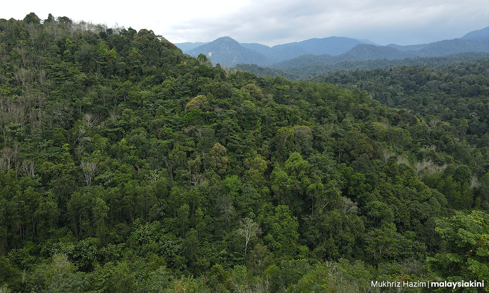
Extensive field studies in North Selangor peat swamp forests can shed light on how to prevent peatland fires. These forests were logged extensively until the 1980s and then drained for adjacent paddy fields.
From June 2001 to April 2013, about 5,568ha of peatland forests were burned here. Peatland fires are mostly caused by fisherfolk who enter forests to fish and then throw cigarette butts that ignite, or from the burning of nearby agricultural land.
Eventually, a peatland fire becomes deadly, can rage for weeks and be very difficult to put out as it spreads above and below the ground.
Restoration efforts
As part of a community-based restoration of peatland swamp forests, the Selangor Forestry Department, in partnership with the Global Environment Centre (GEC) took action to prevent peatland fires in 1,000ha of highly degraded Raja Musa Forest Reserve land, one of the four forest reserves in the North Selangor peat swamps.
Repeated peat fires, caused by neighbouring farmers burning off their land, were one of the major challenges in the restoration programme. In 2012 alone, about 200ha of planted forests in the restoration site were burned.
Action was needed to prevent fires. The GEC made local people aware of the importance of keeping the peatland wet while community teams patrolled the area twice a day to observe any fire incidents.
Several community organisations were formed, such as Friends of North Selangor Peat Swamp Forests and the school-level ‘Peatland Ranger’ programme. They have been actively involved in running awareness programmes in surrounding villages on the importance of peatlands and the devastating effects of forest fires.
The GEC and the Forestry Department also installed several fire danger rating system signs along the periphery of high fire-risk peatland areas.
Patrol teams change the rating daily based on local weather data and the water level of the peatland. If the rating is high to extreme, adjacent communities are alerted via WhatsApp groups and urged to take extra precautions in their agricultural work.
Keeping peatlands wet involves canal blocking, clay dyke construction and even pumping water from ponds and surrounding rivers during long drought periods.
There were hundreds of active canals in the Raja Musa Forest Reserve, constructed to transport logs, which caused the draining of peatland water.
To restore moisture, the GEC, in collaboration with the Forestry Department, volunteers from surrounding villages and environmental enthusiasts, built 132 canal blocks stretching 64.7km from 2010 to 2018. The target was to hit 90km by 2023.
The GEC installed 20 piezometers (pressure measuring instruments) between 2016 and 2018 at the restoration site to estimate the groundwater levels. Patrols took readings every month.
Based on their record, the mean groundwater level was -28.6cm (range -36.0cm to -17.7cm) in 2016. In 2017 it was -26.12cm (-38.6cm to -12.2cm). By 2018 it was -20.16cm (-52.9cm to 4.7cm). These negative values of water readings indicate the presence of water below ground level meaning the peatlands were wet.
In addition to canal blocking, 1.9km of clay dykes (at least 5m in depth and width) were built along the boundary of the forests against a targeted length of 17km. The clay dykes serve as retaining walls and for water storage to prevent surface and subsurface seepage in adjacent areas.
These dykes maintain high water levels in the forest edges which are more prone to fire as the edges are more degraded and closer to farmland. Improved hydrology and canal blocking could be important factors for reducing fire hazards and creating conditions for forest vegetation re-establishment in degraded peatlands.
Thanks to these efforts of regular monitoring, water level improvement, and awareness creation among the nearby farmers, there have been no major fire incidents in the last few years.
Their efforts to restore and rehabilitate the degraded area of the Raja Musa Forest Reserve have shown positive results with the incidence of peatland forest fires greatly reduced. - Mkini
TAPAN KUMAR NATH is a professor at the School of Environmental and Geographical Sciences, University of Nottingham Malaysia.
Originally published under Creative Commons by 360info™.
The views expressed here are those of the author/contributor and do not necessarily represent the views of MMKtT.
No comments:
Post a Comment
Note: Only a member of this blog may post a comment.