


We refer to the Malaysiakini article titled "Forensic Report on Batang Kali Landslide" (FRBK) published Oct 18.
Having first-hand experience of the December 2008 Bukit Antarabangsa landslide and subsequently enriching myself with relevant knowledge via research and seminars on the possible cause of the landslide, I would like to share my views on the shortcomings of the FRBK report.
We can draw a parallel similarity between the two incidents.
The road (B66) was completed in 1990 when the hillside was cut to build the road with the shoulders and roadside drains.
Most likely, the earth from hill cutting is pushed to the lower end (if from Batang Kali to Genting, it would be on the right side). The report failed to highlight this critical point as the strength of compacted earth is much lower than the original soil as it would have a better density than a cut slope.
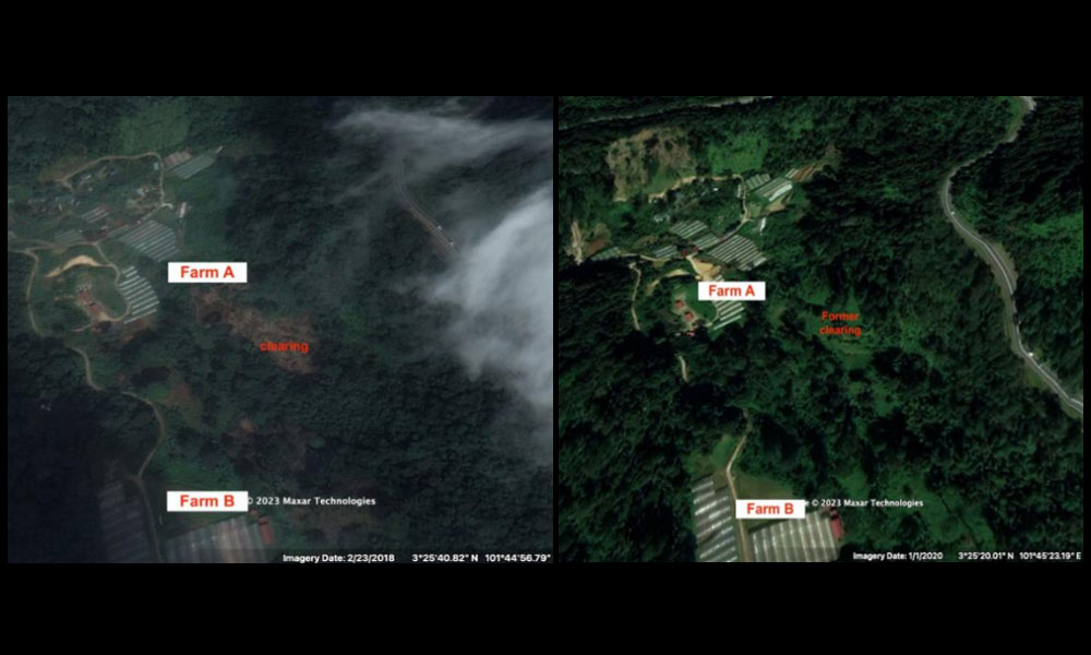
If we were to study images from Google Earth, it showed several key points that were in contrast with the FRBK report.
The image taken on Feb 23, 2018, shows a large area of land between the road and the farm was cleared. In September 2017, the same area appeared to be a dense secondary or primary forest.
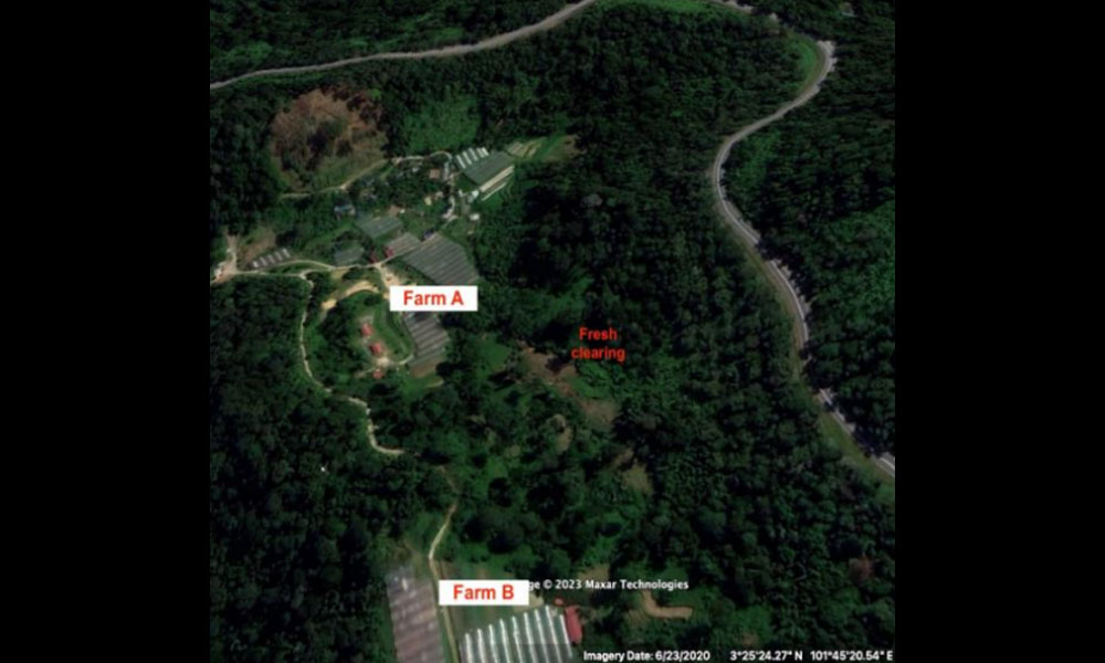
The image dated Jan 1, 2020, shows a land area devoid of trees but filled with what appears to be secondary wild grass or lalang growing over that area and the image taken in June 2020 shows another land-clearing activity at the foothill bordering the farms.
In conclusion, FRBK report saying that there are no anthropogenic (human) activities is incorrect.
The root cause of the slide is a huge amount of water entering the soil at the particular location. The whole area is hilly and it rains everywhere but why does the landslide occur here and not elsewhere in the neighbouring plots? This was not explicitly explained by the report.
According to the report, maintenance work at the slope and road was done as per the schedule. This needs to be reviewed in detail on what was done, and the extent of work done.
From Google Street View, we see that the drains are worn out and there are gaps between the V-shaped drain joining pieces, with several broken pieces.
Most importantly, at the coordinate about here 3.424630, 101.756423, (image taken in November 2020), which is adjacent to the landslide area, we found an unusual sump where water from north and east of the sump pooled and it appears to be damaged by TNB lighting installation.
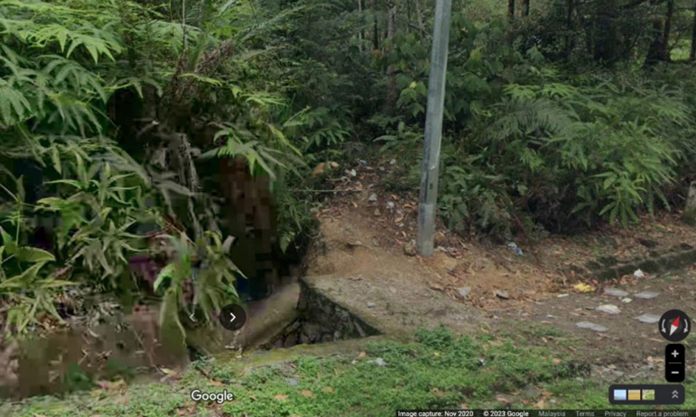
Could this be the root cause of having millions of litres of rainwater flooding the soil in this area and causing it to weaken? This is exactly what happened in the Bukit Antarabangsa landslide in December 2008.
This probably explains why this particular spot gave away and not the rest of the slopes in that area.
Didn’t the investigators note this point when they did the report? From experience, we can say that the slope failed at this point because of several factors which were not thoroughly investigated by the authorities.
The 1990 road and shoulder design, including whether the collapsed slope is a padded filled-up slope.
Contribution to the ongoing land-clearing activities on the slope and adjacent areas.
Seepage via the poor drains.
The most important factor is the sudden pooling of large amounts of water into the slope in this area.
The deceased family members deserve to know the complete picture and investigators are duty-bound to meet and explain matters to them satisfactorily. - Mkini
DR MOHAMED RAFICK KHAN ABDUL RAHMAN is the chairperson of VICTIMS Malaysia.
The views expressed here are those of the author/contributor and do not necessarily represent the views of MMKtT.
No comments:
Post a Comment
Note: Only a member of this blog may post a comment.