


Deforestation at water catchment areas is likely to have led to the devastating mud floods which killed three and displaced more than 600 residents near Baling, Kedah on Monday, environmentalists said.
“This is a straightforward issue. The previous deforestation at water catchment areas like Sungai Kupang and Sungai Tiak had caused the rivers to become shallow due to erosion and sedimentation.
“There is nothing else that can stop the mudflow,” Malaysia Nature Society president Maketab Mohamed said when contacted today.
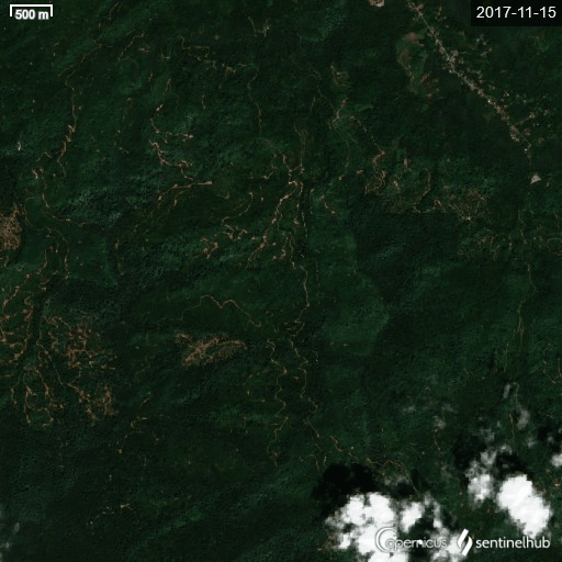
This comes amid speculation that forest clearing several years ago for a durian plantation in the neighbouring Gunung Inas Forest Reserve had caused the flash floods.
However, Kedah Menteri Besar Muhammad Sanusi Md Nor said there is no scientific evidence linking the plantation to the floods and that measures had been taken before this to address the issue.

Energy and Natural Resources Minister Takiyuddin Hassan said no active logging activity had been reported in the Gunung Inas forest reserve area that would have resulted in the flash floods.
Takiyuddin confirmed that there was a 5,000-tree, 52-acre forest plantation in the Gunung Inas Forest Reserve, for which approval was given in 2019, but insisted it did not cause the floods.
‘Hundreds of thousands of hectares cleared’
However, Sahabat Alam Malaysia (SAM) president Meenakshi Raman said this does not negate the impact of forest clearing.
“Takiyuddin’s assertion that 5,000 trees have been planted in a 52-acre area as part of reforestation efforts in the area is no comfort to us when such efforts are insignificant.
“Compared to the hundreds or thousands of hectares which are cleared for plantations or other purposes,” she said.
To come clean on the matter and to regain public confidence, SAM called on the Kedah government to hold a public inquiry to get to the root of the matter.
“Clearly, there is more to these incidents than meets the eye, and if we are to avert another tragedy of this kind, such an inquiry is needed to ascertain what exactly is going on in Kedah in this regard,” she said.

She also debunked Sanusi’s assertion that the floods were caused by the waterhead phenomenon due to heavy rainfall, which in turn caused catchment ponds higher in the mountain to overflow at a faster rate.
According to Environment and Water Ministry director-general Zaini Ujang, rainfall in the catchment area was double the usual rate, leading to floods.
“The waterhead phenomenon cannot be a convenient excuse when we see pictures of large amounts of trees and logs washed down with the gushing of silt-laden waters,” Meenakshi said.
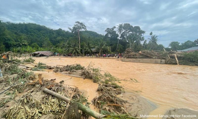
Eyewitnesses said silt-laden floodwater which submerged homes rushed in on villages at great speed, leaving them unable to rescue belongings.
Residents, including senior citizens, said they had to climb trees and cling onto structures for their lives while others carried disabled relatives through neck-deep water.
Photographs of the aftermath in worst-hit Kampung Iboi showed piles of wood debris reaching the roofs of single-storey buildings and demolishing homes.
The three who died included a pregnant woman and her mother-in-law, whose bodies were found hugging under a pile of wood debris some 100m from their home in Kampung Iboi. The older woman’s teenage son’s body was found at another location. - Mkini
No comments:
Post a Comment
Note: Only a member of this blog may post a comment.